Self Setup Geo-Spatial Monitoring Solutions
IoT LiDAR
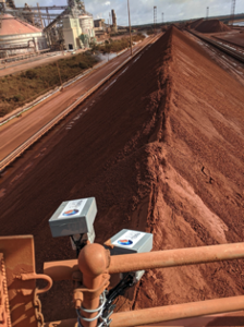
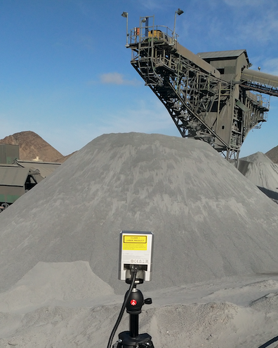
Spatial IoT Platform
- Laser Scanning (IoT Lidar)
- Fleet systems
- Terrestrial-based radar
- Drone or satellite-collected optic and photogrammetric surveys
- Satellite-based Interferometric Synthetic-Aperture Radar (InSar)
- Cleans and fuses all Geospatial data into a single 4D data set
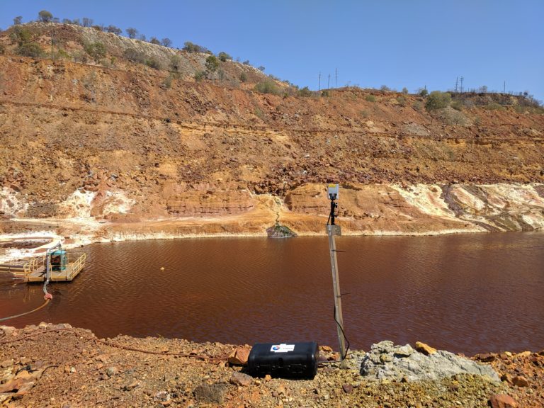
Tailings Dams Monitoring
For most modern mining operations, unplanned structural movements of Tailings Dams embankments are generally classed as High Potential Incidents, which require inspections, reporting and investigation. This often involves sending mine personnel into potentially hazardous areas to collect anecdotal observations and document observations in the form of a written report.
GlassTerra's Self Setup IoT LiDAR provides a faster, safer and cost-effective way to put Tailings Dams possible areas of concern under continuous monitoring and to provide objective, accurate and actionable data on structural movements.
IoT LiDAR can be used when:
- Areas of concern are concealed by ground cover (i.e. vegetation or snow).
- The Stand-off Distance is tight (5m to 260m).
- Areas of concern identified by InSAR or Radar require immediate and detailed monitoring